FOR IMMEDIATE RELEASE
GIS-based workflows support gas and liquid pipeline consequence analysis, as well as tank-integrity planning, with transparent, repeatable deliverables for integrity and compliance-support teams.
HOUSTON, Texas — September 24, 2026 — Altamira today highlighted IntegrityMap HCA™, its proprietary geographic information system (GIS) platform for consequence analysis and integrity decision support across gas pipelines, liquid pipelines and tank facilities. The platform brings pipeline, operating, terrain, hydrologic, structure and spatial data into repeatable GIS workflows designed to help operators evaluate consequential scenarios, document methods and prepare defensible, audit-ready deliverables.
IntegrityMap HCA is designed for GIS managers; pipeline, facility and tank integrity managers; and teams responsible for bringing spatial analysis into integrity-management, engineering and regulatory-review processes. Rather than relying solely on fixed-distance buffers or manual map review, the platform applies documented workflows to the operating and geographic conditions relevant to each analysis.
Gas-pipeline GIS analysis
For gas-pipeline assets, IntegrityMap HCA supports class-location analysis, high consequence area (HCA) identification, moderate consequence area (MCA) screening and gathering classification. The workflow can automate structure counting, pipeline segmentation and Class 1 through Class 4 determinations, including analyses aligned with 49 CFR § 192.5.
The platform also supports Method 1 and Method 2 HCA analyses, population screening and identified-site evaluation. GIS layers, attribute tables, dashboards and documented outputs give pipeline-integrity and GIS teams a common, traceable basis for review.
Liquid-pipeline consequence analysis
For liquid pipelines, IntegrityMap HCA supports high consequence area analysis, worst-case-discharge determinations and emergency flow restricting device (EFRD) assessments within a workflow informed by 49 CFR Part 195. The platform models scenario-specific release volumes, shutdown and response conditions, pipeline drain-down, valve-to-valve segments and available spill volume.
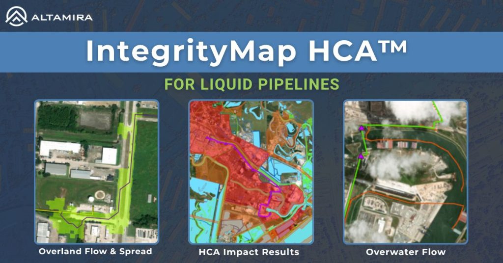
To make release scenarios more representative of the product being evaluated, Altamira can configure product-specific hydrocarbon properties, including physical, volatility and flash characteristics, within the analysis inputs. Its physics-based spill-runout workflow can then evaluate terrain-controlled overland flow, hydrologic connectivity, waterway entry, downstream routing, travel time and modeled impact footprints. Teams can compare baseline and alternative isolation scenarios, assess HCA intersections and produce source-to-impact traceability for engineering and regulatory review.
Tank and facility-integrity application
For storage tanks and facilities, Altamira applies the platform’s GIS and consequence-analysis capabilities to support spatially informed integrity and spill-prevention planning. This work is relevant to the U.S. Environmental Protection Agency’s 40 CFR Part 112 Oil Pollution Prevention requirements, including the Spill Prevention, Control, and Countermeasure (SPCC) planning framework for applicable facilities.
By organizing facility, tank, drainage, containment, topographic and sensitive-receptor data within a common GIS environment, integrity teams can better document the geographic context of their planning and review decisions.
Regulatory frameworks addressed
| Asset focus | IntegrityMap HCA workflow | Regulatory framework addressed |
|---|---|---|
| Gas pipelines | Class location, HCA and MCA identification, gathering classification, reporting | 49 CFR Part 192, including 49 CFR § 192.5 for class-location analysis |
| Liquid pipelines | HCA analysis, product-specific release modeling, spill routing, EFRD scenario analysis | 49 CFR Part 195 |
| Tanks and facilities | Facility and tank spatial context, consequence mapping and spill-prevention planning support | EPA 40 CFR Part 112, including the SPCC planning framework for applicable facilities |
Leadership grounded in mission-critical GIS experience
Altamira’s GIS Services Division is led by Dustin Sanchez, Manager of GIS. Sanchez brings nearly two decades of spatial-intelligence and terrain-analytics experience, including eight years of military service and nine years in the energy industry focused on emergency response and crisis management. His background includes mission-critical GIS programs, terrain analysis, LiDAR modeling, flood-pathway simulation, enterprise geodatabase design and Python-driven workflow automation.
Under Sanchez’s leadership, Altamira is applying that operational experience to GIS workflows that help energy-infrastructure teams convert complex spatial and operating data into transparent, reviewable decision support.
Built for reviewable decisions
IntegrityMap HCA is intended to support—not replace—operator engineering judgment, data validation, program governance and regulatory-compliance determinations. Project outputs depend on the quality and completeness of the underlying asset, operating, terrain, hydrologic and geographic data, and should be reviewed within each operator’s applicable integrity-management and compliance programs.
To learn more about IntegrityMap HCA and Altamira’s GIS services, contact Dustin.Sanchez@Altamira-us.com
About Altamira
Altamira is an engineering and environmental consulting firm specializing in regulatory compliance, digital solutions and strategic advisory services. The company supports clients across asset integrity, pipeline safety, environmental health and geospatial analytics.